The Importance of the Nile River in Ancient Egypt
The Nile River created Egypt. Without this mighty waterway flowing northward for over 4,000 miles through the heart of Africa, the remarkable civilization that built pyramids, developed hieroglyphics, and ruled for three millennia would never have existed.
Ancient Egypt’s entire existence revolved around the annual rhythm of the Nile’s floods, which transformed a harsh desert landscape into one of the ancient world’s most prosperous societies. The river didn’t just provide water – it delivered fertile soil, enabled trade routes, and shaped religious beliefs that endured for centuries.
We’ve studied Egypt’s ancient monuments for decades, guiding travelers through temples and tombs that tell this incredible story. The connection between the Nile and Egyptian civilization remains one of history’s most fascinating examples of how geography shapes human destiny.
Geographic Foundation of Egyptian Civilization
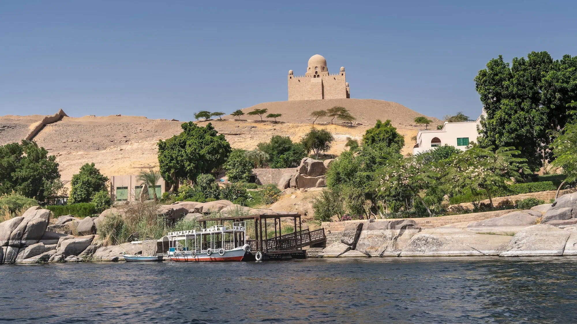
Three distinct regions defined ancient Egypt’s relationship with the Nile River. Upper Egypt stretched from the first cataract at Aswan to just south of modern-day Cairo, where the river carved through sandstone cliffs and granite formations.
This southern region, despite its name, sat at higher elevation and controlled the river’s flow into Lower Egypt. The narrow valley here concentrated agricultural land into a thin green strip rarely more than 10 miles wide on either side of the river.
The Nile Delta Heart
Lower Egypt encompassed the vast delta region where the Nile split into multiple branches before emptying into the Mediterranean Sea. Ancient Egyptians called this fertile land “Kemet” – the black land – referring to the rich, dark soil deposited by annual floods.
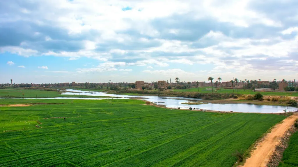
The contrast with “Deshret,” the red desert land beyond the flood zone, couldn’t have been starker. The delta’s fan-shaped expanse covered roughly 15,000 square kilometers of prime farmland.
Natural Barriers and Protection
The Nile’s geography provided natural defense for Egyptian civilization. Cataracts – rocky rapids and waterfalls – blocked easy navigation at six points along the river’s course through Egypt.
These geographic features allowed Egyptian culture to develop with remarkable continuity over thousands of years. Unlike Mesopotamia, which faced constant invasions across open plains, Egypt’s natural boundaries created stability that fostered innovation.
Annual Flood Cycle That Sustained Egypt
Hapi, the androgynous god of fertility, brought life to Egypt each year through the Nile’s inundation. This wasn’t mere religious symbolism – the annual flood cycle literally determined whether Egyptians would feast or face famine.
The flood season, called “Akhet,” typically began in June when summer monsoons in the Ethiopian highlands swelled the Blue Nile tributary. Water levels rose gradually through July and August, reaching peak flood stage by September.
Egyptian farmers planned their entire year around this predictable rhythm. When floodwaters receded in October, they left behind a fresh layer of fertile silt that eliminated the need for fertilizers.
Managing Flood Technology Innovation
Ancient Egyptians developed sophisticated systems to maximize the Nile’s benefits while minimizing flood damage. Basin irrigation divided farmland into large, flat basins surrounded by earthen walls.
Nilometers represented Egyptian engineering at its finest. These stepped wells or graduated columns allowed priests and administrators to monitor water levels with remarkable precision.
Insufficient floods brought disaster. When the Nile failed to rise adequately, crop yields plummeted and famine stalked the land. Egyptian texts describe years when “the Nile was sluggish” or when “the flood was too great.”
Religious Beliefs Shaped by Rivers
The Nile River permeated every aspect of Egyptian religious thought and practice. Hapi embodied the life-giving force of the annual inundation with artistic depictions showing this deity as an androgynous figure with pendulous breasts and protruding belly.
Blue skin represented the floodwaters, while green indicated vegetation that followed. The god carried symbols of Upper and Lower Egypt – lotus flowers and papyrus plants – binding them together to represent national unity through the river’s power.
Death and Rebirth Rivers
Egyptian afterlife beliefs reflected the Nile’s annual cycle of death and renewal. Osiris, god of the underworld, underwent dismemberment and resurrection that mirrored the agricultural year.
Mummification practices developed partly due to the Nile’s influence on burial customs. Annual floods made riverside burial impossible, forcing Egyptians to inter their dead in the desert beyond the flood zone.
Temple Ceremonies River Festivals
Major religious festivals coincided with flood stages and agricultural seasons. The Opet festival during inundation season celebrated the pharaoh’s divine rejuvenation through association with Amun-Ra.

Sacred barges carried gods along the river during ceremonial processions. These elaborate boats, crafted from Lebanon cedar and decorated with gold, demonstrated the importance of river transport in religious practice.
Economic Foundation Trade and Transportation
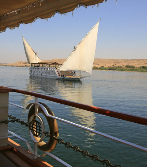
Egypt’s prosperity depended on the Nile’s role as a superhighway connecting the Mediterranean world with tropical Africa. Ancient Egyptians mastered river navigation thousands of years before other civilizations developed comparable maritime skills.
Early boats consisted of bundled papyrus reeds lashed together with rope. These lightweight vessels could carry substantial loads while remaining maneuverable in shallow water.

Wooden ships represented major technological advances. Cedar imported from Lebanon created strong, durable hulls capable of carrying tons of cargo. Egyptian shipwrights developed steering oars, square sails, and sophisticated rigging systems.
Trade goods flowed along this river highway in both directions. Gold from Nubian mines traveled north through cataracts on specialized boats designed for rapids navigation.
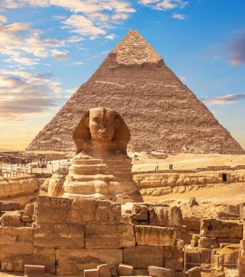
River transport enabled massive construction projects that would have been impossible using land routes. The Great Pyramid at Giza required approximately 2.3 million stone blocks, many quarried hundreds of kilometers upstream.
Agricultural Innovation and Food Security
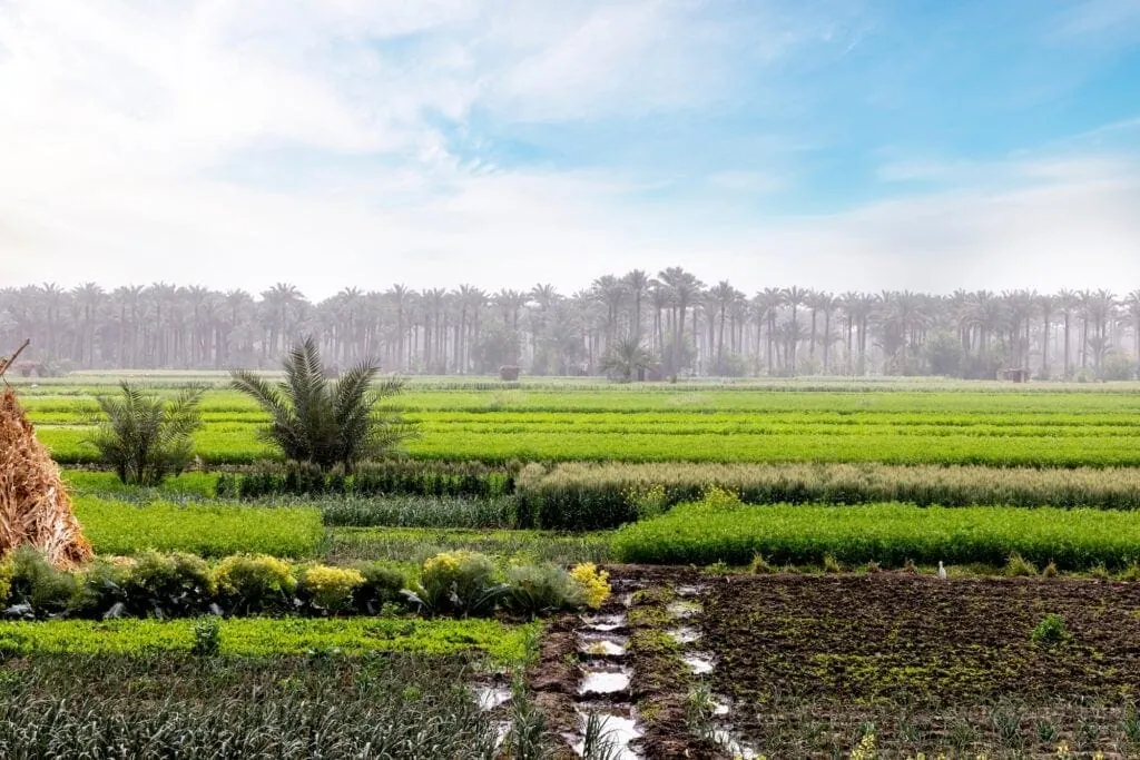
Egyptian civilization achieved food security levels unmatched in the ancient world through ingenious agricultural techniques adapted to Nile flood patterns. Farmers cultivated multiple crops suited to different flood conditions and soil types.

Emmer wheat and barley formed staple grains that thrived in the rich silt deposited by floods. Flax provided fiber for linen textiles, while various vegetables and legumes added nutritional diversity to Egyptian diets.
Storage Distribution Networks
Granaries represented ancient Egypt’s most crucial infrastructure after irrigation systems. Massive stone silos stored surplus grain against years of poor floods or crop failures.
Royal administration carefully managed grain distribution through a sophisticated bureaucracy. Scribes recorded harvest yields, calculated tax obligations, and distributed rations to workers on royal projects.
Legacy of Nile River Connection
Modern Egypt still depends heavily on Nile water resources, though the relationship has fundamentally changed since ancient times. The Aswan High Dam, completed in 1970, eliminated the annual flood cycle that sustained pharaonic civilization for millennia.
Archaeological discoveries continue revealing new aspects of ancient Egypt’s relationship with the Nile. Recent excavations have uncovered sophisticated hydraulic systems, harbor installations, and settlement patterns.
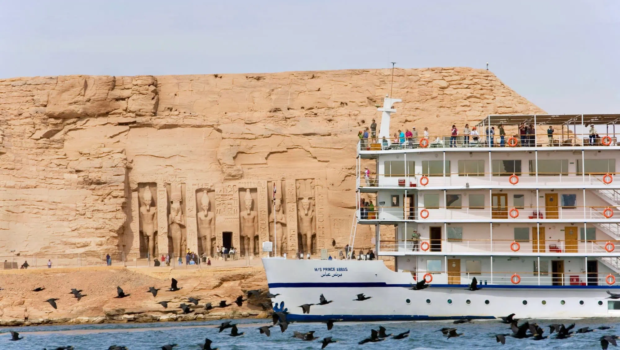
We’ve guided thousands of travelers along the Nile’s historic route, from the temples of Abu Simbel in the south to the Mediterranean coast in the north. The river that created Egyptian civilization continues to showcase humanity’s oldest achievements.
Understanding ancient Egypt’s connection to the Nile River provides crucial context for appreciating the civilization’s achievements. The pyramids, hieroglyphic writing, sophisticated art, and complex religious systems all developed within the framework of river transport and flood cycles.
Frequently Asked Questions
The Nile stretches 6,650 km from East Africa to the Mediterranean Sea, making it the world’s longest river.
Summer monsoons in the Ethiopian highlands swelled the Blue Nile tributary, causing predictable floods from June through September.
Nilometers – graduated wells or columns – allowed priests to monitor water levels precisely and predict agricultural outcomes weeks in advance.
Emmer wheat, barley, flax, vegetables, legumes, and date palms formed the basis of Egyptian agriculture in flood-enriched soil.
The river provided the only practical transportation route through Egypt, enabling trade, construction projects, and communication across the entire kingdom.
Annual flood cycles shaped beliefs about death and rebirth, influenced major festivals, and led to worship of Hapi, the fertility god.
Insufficient floods caused crop failures, famine, and social unrest that could destabilize the entire Egyptian kingdom for years.
Early vessels used bundled papyrus reeds, while later wooden ships featured cedar hulls, square sails, and sophisticated steering systems.
Upper Egypt occupied the narrow southern valley at higher elevation, while Lower Egypt encompassed the broad northern delta region.
The Aswan High Dam eliminated natural floods by storing water in Lake Nasser, fundamentally changing Egypt’s relationship with the river.
These measuring devices helped predict harvests, adjust taxation, and manage grain distribution throughout the kingdom based on flood levels.
Annual floods made riverside burial impossible, forcing Egyptians to use desert cemeteries where dry conditions naturally preserved remains.


Design Your Custom Tour
Explore Egypt your way by selecting only the attractions you want to visit