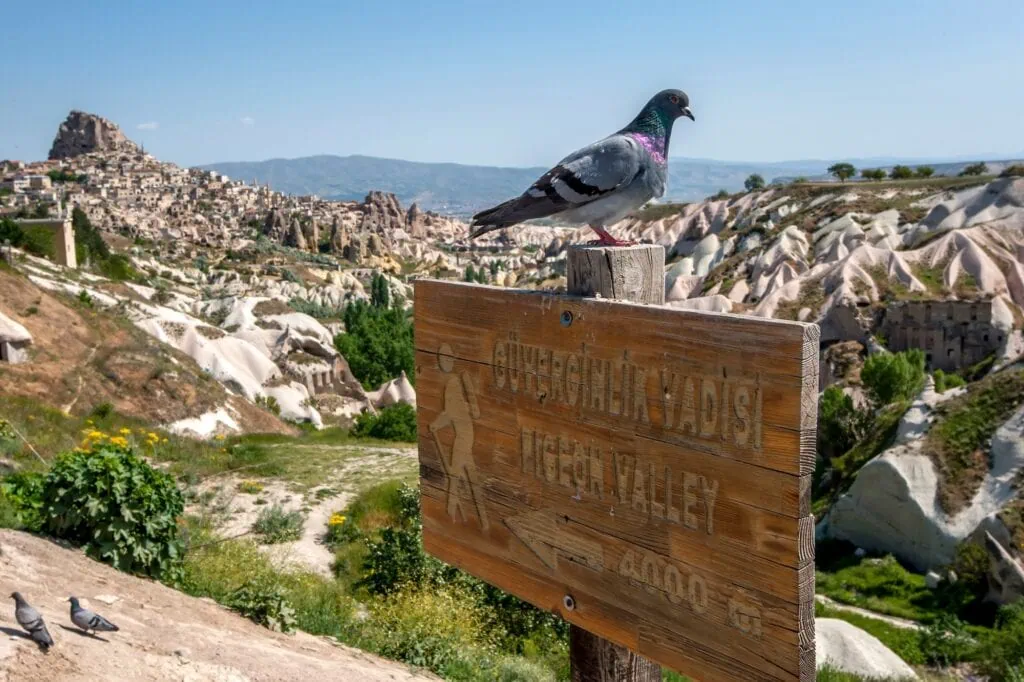
Pigeon Valley In Cappadocia – A Helping Hand From Mother Nature
Step into a landscape where history and nature merge seamlessly.
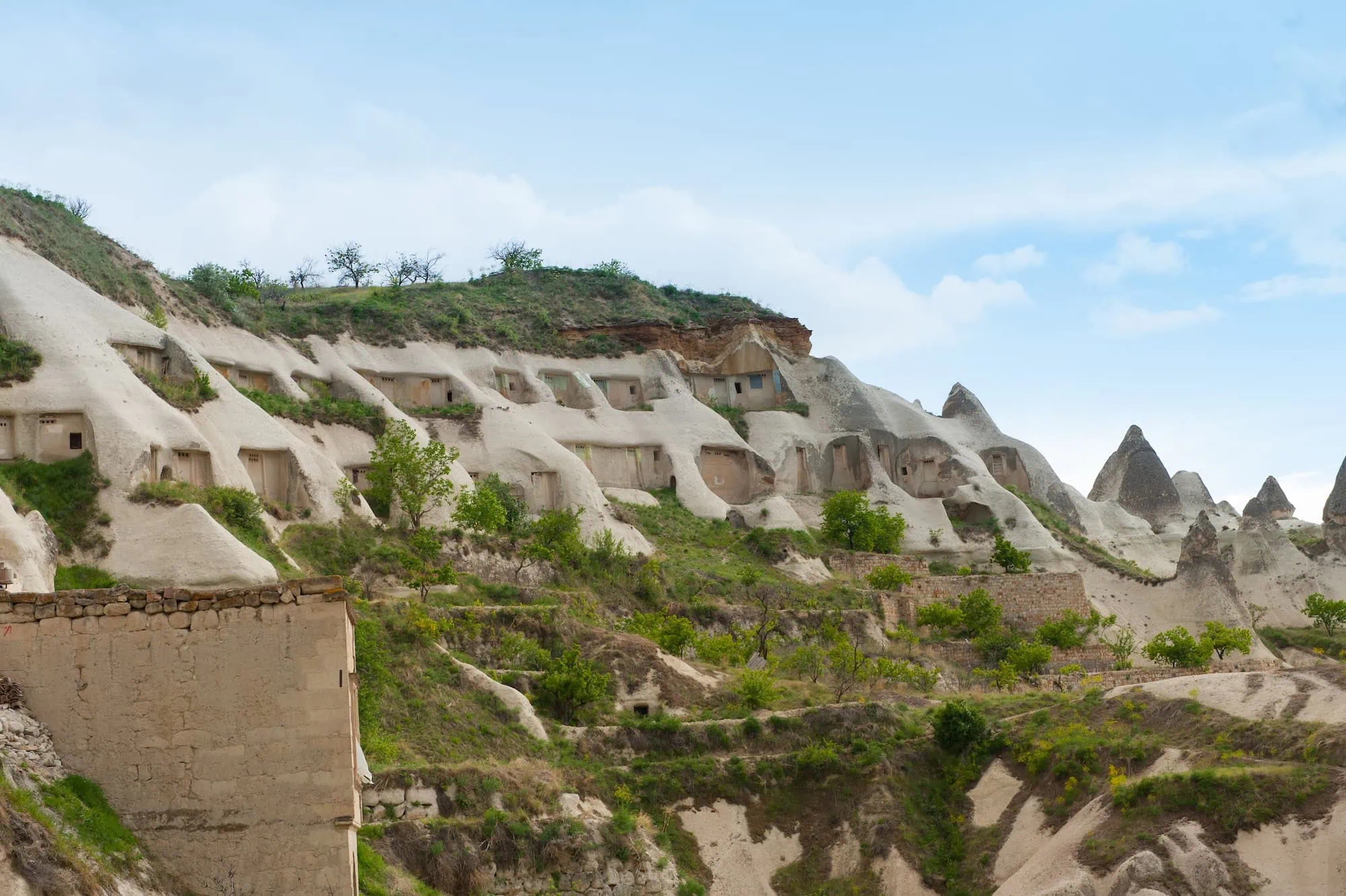
Pigeon Valley stretches 4.1 kilometers between Göreme and Uçhisar, cutting through soft volcanic rock formations filled with thousands of ancient dovecotes. These small carved structures are more than just visual highlights—they reflect a clever agricultural system where pigeons played a vital role in fertilizing the land.
Pigeon Valley can be included in our Egypt and Turkey Travel Packages, where Cappadocia’s unique landscapes are combined with Istanbul’s historic sites and Egypt’s ancient wonders for a rich and varied travel experience.
The valley’s Turkish name, Güvercinlik Vadisi, reflects the deep connection between local communities and these birds—a relationship that shaped daily life in the region for centuries. Today, it remains one of Cappadocia’s most scenic and culturally significant hiking areas.
With extensive experience guiding travelers through this UNESCO-listed region, we help uncover the stories and details that bring this extraordinary landscape to life.
Table of Contents
Walking the Historic Pigeon Valley Trail
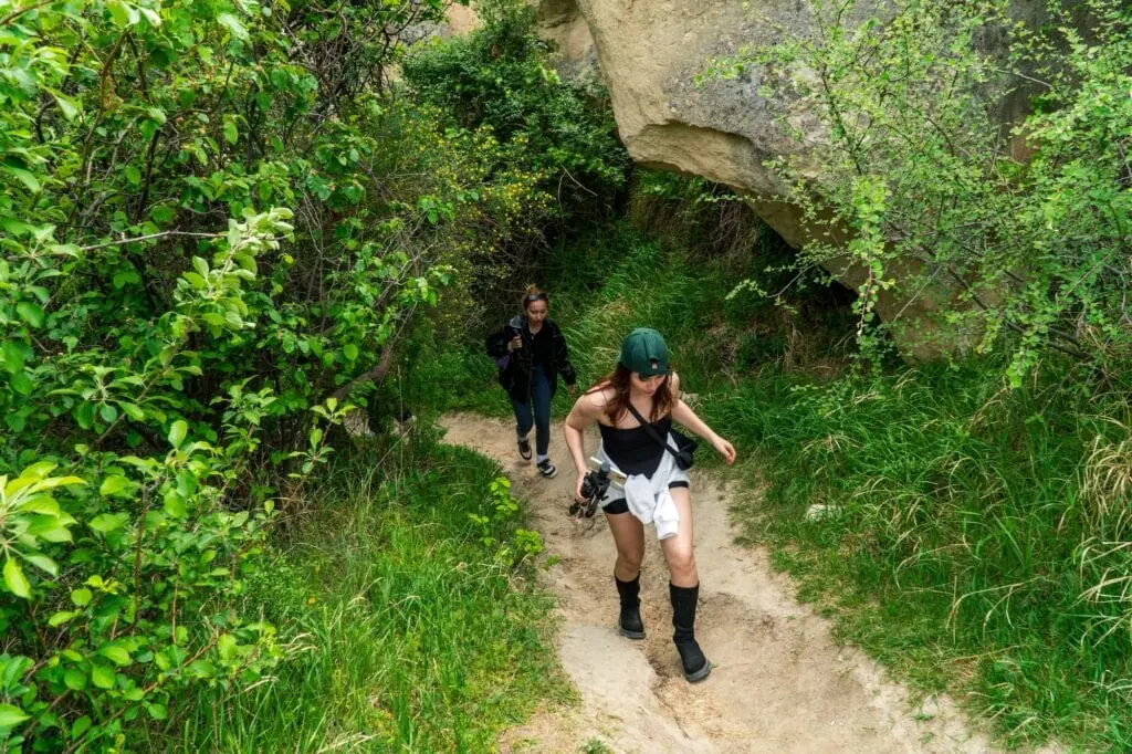
The main hiking trail connects two of Cappadocia’s most important towns through terrain that changes dramatically with each step. Starting from Göreme, the path descends gradually through fairy chimney formations before reaching the valley floor.
Trail Conditions and Navigation
Most hikers complete the route in 45 to 60 minutes, though photography stops can easily extend this to two hours. The trail surface varies from packed earth to rocky sections, requiring sturdy walking shoes but remaining accessible to most fitness levels.
Clear markers guide walkers along the primary route, while several branching paths lead to viewpoints and cave churches. The most challenging section occurs midway through the valley where loose rocks create uneven footing. Recent maintenance has improved safety, but caution remains essential during wet conditions.
Optimal Timing for Your Visit
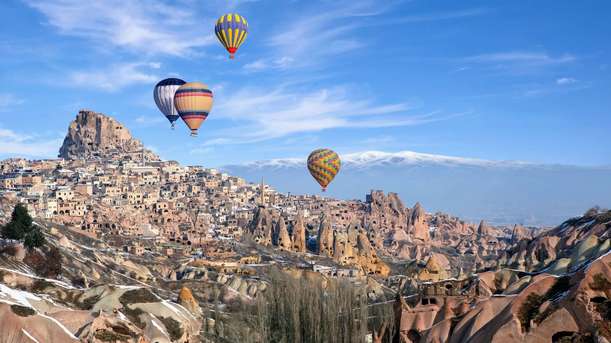
Early morning visits between 7:00 am (07:00) and 9:00 am (09:00) offer cooler temperatures and the best photography light. Hot air balloon tours often pass overhead during these hours, creating spectacular photo opportunities.
Afternoon walks provide different lighting but can be uncomfortably warm during summer months when temperatures reach 35°C (95°F). Winter hiking presents its own appeal, with snow-dusted pigeon houses creating ethereal scenes rarely captured by summer visitors.
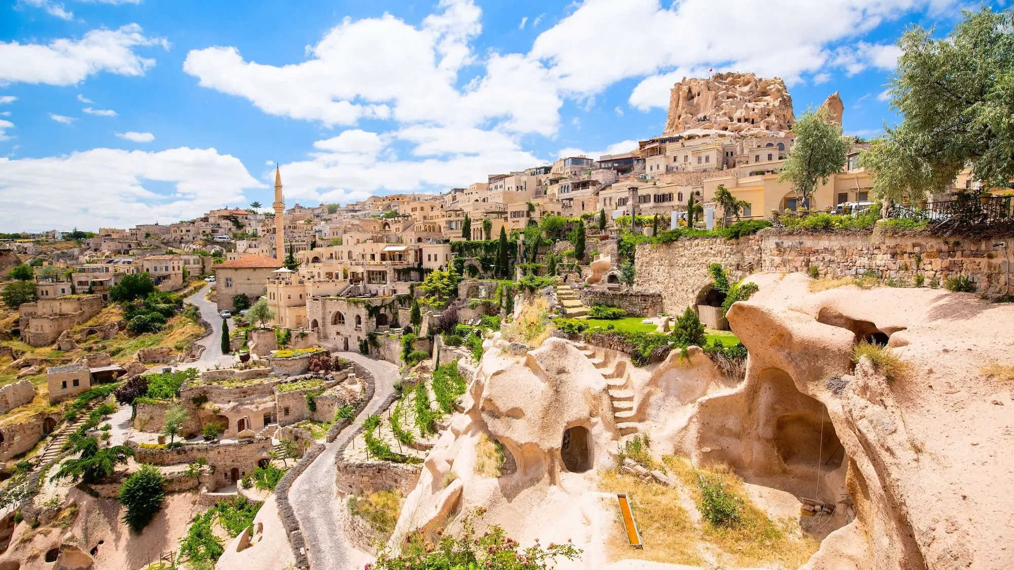
Connecting to Uçhisar Castle
The trail’s endpoint at Uçhisar provides direct access to Cappadocia’s highest point. This natural citadel rises 60 meters (197 feet) above the valley floor, offering panoramic views across the entire region.
Many visitors combine their Pigeon Valley hike with castle exploration, creating a half-day adventure that showcases both intimate valley details and sweeping regional vistas.
The Ancient Art of Pigeon Keeping
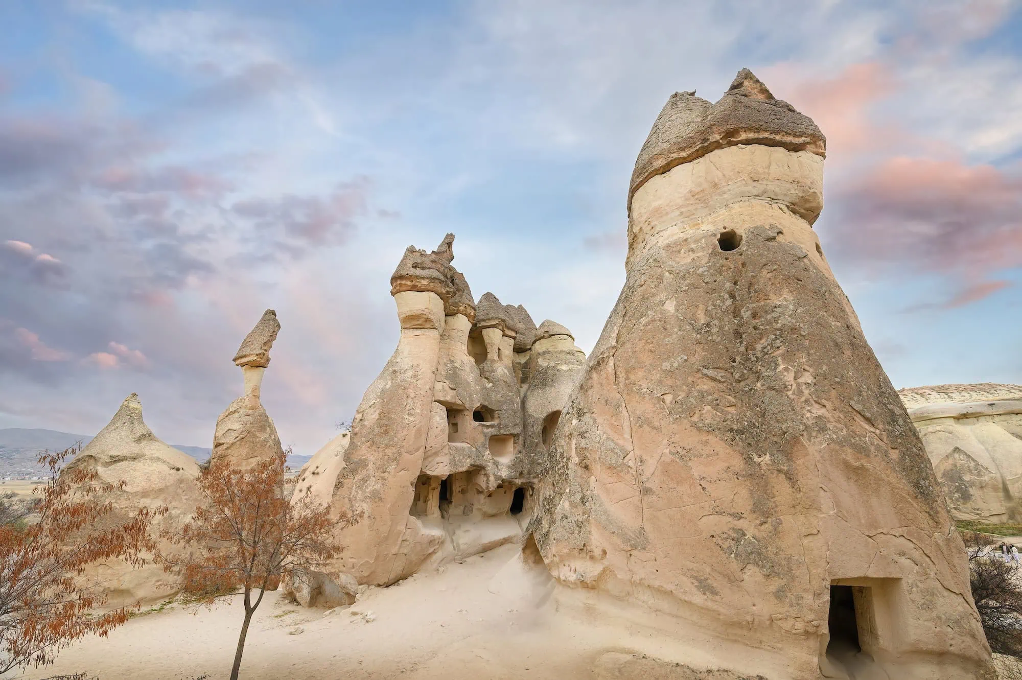
Thousands of carved niches dot Pigeon Valley’s cliff faces, each representing hours of careful excavation into volcanic tuff. Byzantine communities created these dovecotes not for sport or pleasure, but as essential components of their agricultural economy.
Pigeons provided two crucial resources that transformed farming in this arid landscape. Their droppings created nitrogen-rich fertilizer that dramatically improved crop yields in Cappadocia’s challenging soil conditions. Additionally, pigeon eggs supplemented diets during harsh winters when other protein sources became scarce.
Archaeological evidence suggests some dovecotes housed up to 1,000 birds, indicating the scale of these operations. The white paint surrounding each entrance served multiple purposes. It helped pigeons locate their specific nesting sites from great distances, while also reflecting heat to maintain cooler interior temperatures.
This simple but effective design element demonstrates the sophisticated understanding these ancient communities possessed about both animal behavior and environmental adaptation. Modern pigeon populations remain smaller than historical numbers, but active nests continue throughout the valley, maintaining the living connection between past and present that makes this destination uniquely compelling.
Geological Formations and Natural Features
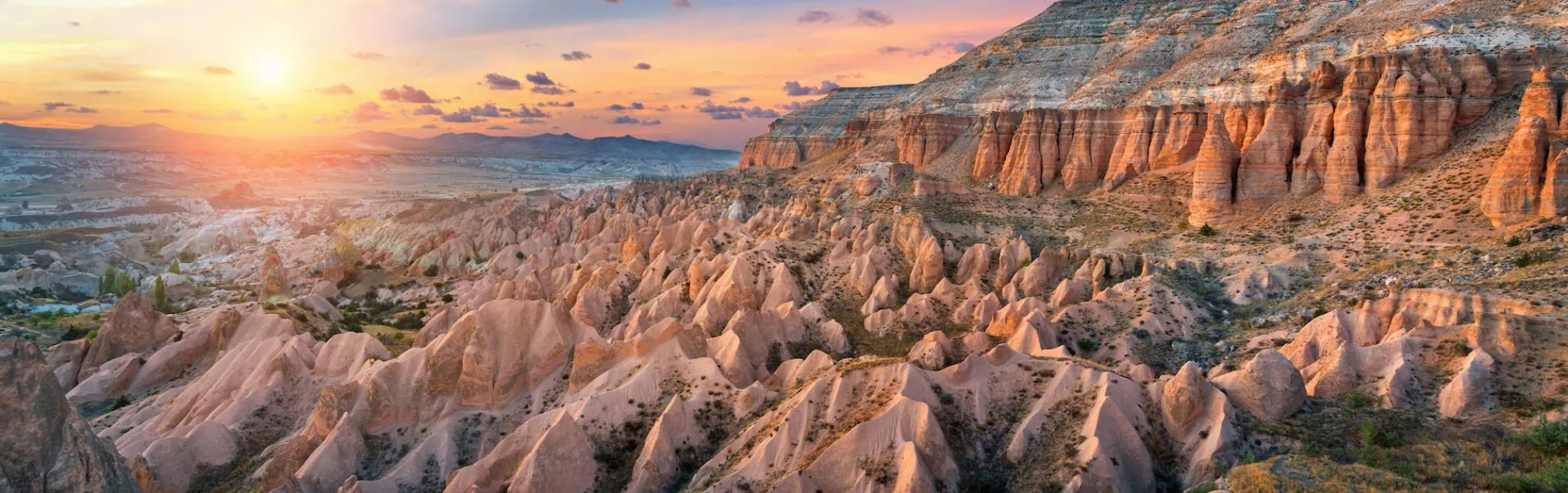
Volcanic activity 60 million years ago created the tuff layers that define Pigeon Valley’s character. These compressed ash deposits proved soft enough for hand excavation while remaining stable enough to support complex cave systems. The result is a landscape where natural erosion and human modification blend seamlessly.
The valley floor slopes gently from 1,100 meters (3,609 feet) elevation near Göreme to 1,050 meters (3,445 feet) approaching Uçhisar. This modest grade creates ideal hiking conditions while allowing for natural water drainage that carved the valley’s current shape over millennia.
Fairy chimney formations concentrate near the Uçhisar end, where harder caprock protected underlying tuff from complete erosion. These distinctive cone shapes house some of the valley’s most photographed pigeon houses, their entrances carved into surfaces that appear almost vertical from ground level.
Rock formations reveal distinct geological layers through exposed cliff faces. The lightest bands represent periods of intense volcanic activity, while darker sections indicate soil deposits between eruptions. Understanding this geological timeline helps visitors appreciate the immense time scales involved in creating today’s landscape.
Water continues shaping the valley through seasonal streams that flow after heavy rains. A small waterfall near the midpoint reaches 10-15 meters (33-49 feet) in height during peak flow periods, creating a refreshing stop for hikers and supporting the valley’s limited vegetation.
Cultural Heritage and Historical Significance
Christian Communities and Cave Churches
Early Christian settlements utilized Pigeon Valley’s natural caves for religious purposes alongside agricultural activities. Several cave churches contain frescoes dating from the 9th to 11th centuries, though many remain difficult to access without specialized equipment.
The Church of St. Basil features the valley’s most complete decorative program, with scenes from Christ’s life preserved despite centuries of weathering. Its location deep within a fairy chimney required significant excavation, suggesting the importance these communities placed on creating sacred spaces within their working environment.
Agricultural Innovation
The integration of pigeon keeping with farming represents one of Cappadocia’s most successful adaptations to challenging environmental conditions. Communities developed sophisticated rotation systems where fields received pigeon fertilizer for two seasons before lying fallow for one year.
This agricultural model supported populations far larger than the region’s natural carrying capacity would normally allow. Historical records suggest peak pigeon production occurred during the 12th and 13th centuries when Byzantine agricultural techniques reached their most advanced stage.
Trade and Communication Networks
Pigeons served communication purposes beyond their agricultural value. Messages carried between Göreme and Uçhisar helped coordinate market activities and religious festivals. This communication network extended throughout central Anatolia, connecting isolated communities with regional trade centers.
The strategic position of Pigeon Valley made it a natural waypoint for travelers moving between major settlements. Caravanserais near both valley entrances provided accommodation and services for merchants, creating economic opportunities that persisted long after the Byzantine period ended.
Planning Your Pigeon Valley Adventure
Transportation and Access Points
Both Göreme and Uçhisar offer convenient starting points, with paved roads leading directly to marked trailheads. Public buses connect both towns with Nevşehir’s central bus station, while rental cars provide maximum flexibility for exploring multiple sites in a single day.
Most visitors choose Göreme as their base due to its larger selection of accommodations and restaurants. We arrange private transportation that allows you to start hiking at optimal times while avoiding the crowds that develop during midday hours. Our drivers familiar with the region can suggest alternative viewpoints and photography locations that independent travelers often miss.
Essential Preparation Items
Water requirements vary significantly by season, with summer hikes demanding at least one liter per person. Comfortable hiking shoes with good ankle support prove essential on rocky sections, though specialized hiking boots aren’t necessary. Sun protection becomes critical during exposed sections where shade remains limited.
Camera equipment benefits from extra battery power, as the combination of cold temperatures and extensive photography quickly drains standard batteries. Telephoto lenses help capture pigeon house details from safe distances while wide-angle options work better for landscape photography.
Safety Considerations
The valley’s remote sections lack cellular coverage, making group travel advisable for less experienced hikers. Weather conditions change rapidly, particularly during spring and fall when sudden storms can create flash flood conditions in narrow sections.
Emergency exits exist at several points along the main trail, connecting to vehicle-accessible roads above the valley floor. Familiarizing yourself with these locations before starting your hike provides important safety backup options.
Frequently Asked Questions
Most people complete the 4.1-kilometer trail in 45-90 minutes, depending on fitness level and photo stops.
Yes, pigeons still nest in many of the ancient dovecotes, particularly during spring and summer months.
The main path works well for ages 8 and above with reasonable fitness, though some rocky sections require caution.
April through June and September through November offer ideal weather conditions and comfortable hiking temperatures.
The hiking trail itself is free, though some associated cave churches may charge small admission fees.
Look for white paint around entrances, rectangular shapes, and multiple chambers carved in organized patterns.
Yes, its location between Göreme and Uçhisar makes it easy to include with Göreme Open Air Museum or Uçhisar Castle visits.
Well-maintained signs and obvious paths make independent navigation straightforward for most of the route.
Lizards, small songbirds, and occasional raptors inhabit the valley, along with various butterfly species during warmer months.
Limited facilities exist at both Göreme and Uçhisar endpoints, but none along the trail itself.
It offers easier terrain than Love Valley or Red Valley while providing better historical context than purely geological trails.
We provide experienced guides who explain the valley’s agricultural history, geological formation, and current conservation efforts in detail.
Design Your Custom Tour
Explore Egypt and Turkey your way by selecting only the attractions you want to visit